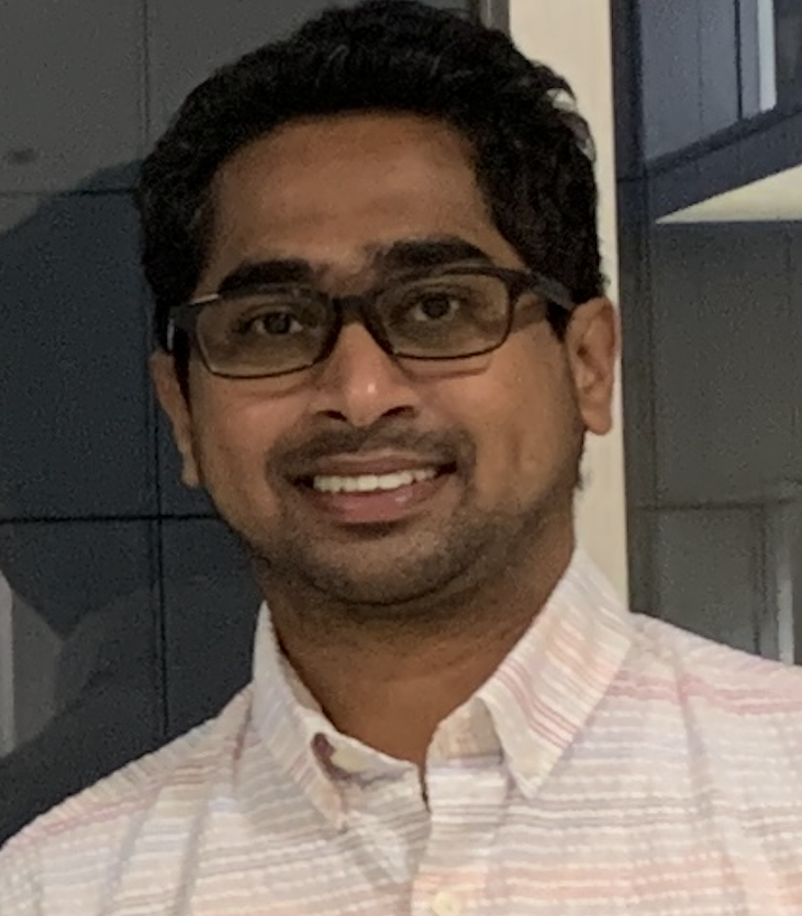
- Faculty of Architecture
- Department of Town & Country Planning
- Lecturer (Probationary)
Contact information
Department of Town & Country Planning
Faculty of Architecture
University of Moratuwa
Moratuwa
10400
Teaching and Administrative Activities
WebGIS -Undergraduate -2019
WebGIS -Undergraduate -2021
Spatial Planning & Design Studio I -Undergraduate -2020
Site Planning & Design Studio -Undergraduate -2021
Spatial Planning & Design Studio I -Undergraduate -2022
Introduction to Real Estate -Undergraduate -2022
Introduction to Real Estate -Undergraduate -2023
Geo-Spatial Analysis -Undergraduate -2023
Programming GIS -Undergraduate -2023
Programming GIS -Undergraduate -2023
Level Coordinator : Level 1 - T&CP - Level Coordinator - (2022 To date)
Level Coordinator : Level 1 - T&CP - Level Coordinator - (2023 To date)
Student Learning Environment facilities Coordinator - (2023 To date)
Learning Management System Coordinator - (2023 To date)
Department Industry Consultative Board (DICB) Coordinator - (2023 To 2024)
Research Activities
OSHW & FOSS application in spatial planning
Geospatial data analysis
Open source GIS applications, Web GIS, Geo-Spatial data analysis, Remote Sensing, GIS, Geo-IoT
Education and Professional Affiliations
Masters, Osaka City University ,2018 Urban Informatics
Bachelors, University of Moratuwa ,2014 Town & Country Planning
PhD, Osaka City University ,2021 Reading
Associate Member - Institute of Town Planners(2014 To date)
Charter Member - OSGeo (2017 To date)
Member of Institute of Electrical and Electronics Engineers (SSIT)(2025 To date)
Career
Honours and Awards
MEXT (The Japanese Ministry of Education, Culture, Sports, Science and Technology, Monbukagakusho) Scholarship (Received 2016)
Award for the Best Poster Presentation at the FOSS4G-Asia 2014, Thailand (Received 2014)
Award for the Best Poster Presentation at the FOSS4G NARA.KANSAI, Japan (Received 2016)
FOSS4G Asia 2017 Code Challenge: WINNER, India (Received 2017)
Publications*
SELVARATNAM.V , BANDARA.N.S AND JAYASINGHE.A.B, HASAN MAF,".MEASURING LIVING STRUCTURE ACROSS VARIOUS LEVELS OF URBAN HIERARCHY: A COMPARATIVE STUDY IN DIVERSE URBAN CONTEXTS IN SRI LANKA.",FARU 2024 Annual Conference,University of Moratuwa,2024,
Kasthurisinghe K., Bandara N.S., Jayasinghe A.B.,".An Open-Source Approach for Measuring Level of Urbanity.",Asian Conference on Remote Sensing (ACRS 2024),Colombo, Sri Lanka,2024,
Hashanka Galagedara, Niroshan Bandara,".Mapping On-road Driver Experiences of Main Roads: Application of Artificial Intelligence, GIS, and Google Maps.",Research for Transport and Logistics Industry,University of Moratuwa,2023,186-188
N.S BANDARA , TABATA Hideyuki, UEDA Mitsunori, Mitsunori UEDA, YOSHIDA Daisuke and Venkatesh RAGHAVAN,".Development of Free and Open Source Platform for Near Real-Time Acquisition of Water Quality Parameters.",GEOINFORUM,Japan,2021,5-6
A. S. Sathsarana, A.B. Jayasinghe, N.S. Bandara, R. Ratnayake, P.K.S. Mahanama,".An Open-Source Approach To Map Land Use In Urban Areas: Based On Deep Learning Technology.",FOSS4G Asia 2021,Kathmandu University, Nepal,2021,
L.D.C.H.N. Kalpana, A.B. Jayasinghe, C.C. Abenayake, C.K.D. Silva, N. Sanjaya,".Novel Approach to Delineate Cities and Their Population Based on Open Source GIS Applications, Machine Learning and Open-Data.",FOSS4G Asia 2021,Kathmandu University, Nepal,2021,
M.N.N. Ranaweera, A,B, Jayasinghe, C.C. Abeynayake, N.S. Bandara, C.K. de Silva,".Model Land Fragmentation by Using Feed Forward Neural Network and Decision Tree: Case of Western Province, Sri Lanka.",FOSS4G Asia 2021,Katmandu, Nepal,2021,
N.S BANDARA , Mitsunori UEDA and Venkatesh RAGHAVAN,".Development of Geo-IoT Platform for Water Quality Monitoring .",GEOINFORUM,Japan,2020,21-22
N.S. Bandara, V. Raghavan,".Development of Service Oriented Framework for Geospatial Field Data Management and Analysis.",GEOINFORUM,Nara University, Nara, Japan,2018,23-24
N. Wickramaarachchi, N. S. Bandara, R. Ratnayake, P.K.S. Mahanama, A.B. Jayasinghe,".Exploring The Need And The Sustainability of an Open Source Platform For Dengue Prevention In Sri Lanka.",FOSS4G Asia,Moratuwa, Sri Lanka,2018,
Bandara N.S. , Raghavan V., Fenoy G., Yoshida D.,".Mobile Data Collection with Human and Sensor Inputs.",FOSS4G EUROPE,Paris, France ,2017,
N.S. Bandara, V Raghavan, D Yoshida,".Developing service oriented framework for integration of field data into GIS using FOSS4G stack.",FOSS4G Asia ,Hyderabad, India ,2017,
Bandara N.S , Fenoy G., Raghavan V., Yoshida D.,".Simplifying integration of field data and GIS: A WPS approach.",International Conference on GeoInformatics for Spatial-Infrastructure Development in Earth & Allied Sciences (GIS-IDEAS),Hanoi, Vietnam ,2016,
Jayasinghe P, Raghavan V., Bandara N.S, Yonezawa G. ,".Identifying the relationship between land cover change and land surface temperature increase in Colombo City, Sri Lanka ŌĆō A remote sensing and GIS approach.",International Conference on GeoInformatics for Spatial-Infrastructure Development in Earth & Allied Sciences (GIS-IDEAS),Hanoi, Vietnam ,2016,
Bandara N.S , Fenoy G., Raghavan V., Yoshida D.,".Field Data Collecting, Processing and Sharing: Using web Service Technologies.",FOSS4G NARA.KANSAI,Nara, Japan,2016,
Chemin Y, Bandara N.S , Eriyagama N. ,".A National Upgrade of the Climate Monitoring Grid in Sri Lanka. The Place of Open Design, OSHW and FOSS.",European Geosciences Union General Assembly ,Vienna, Austria ,2015,
Chemin Y, Bandara N.S , Liyanage P.K.N.C. ,".An Open Source Hardware & Software online raingauge for real-time monitoring of rainwater harvesting in Sri Lanka.",RWH symposium, Lanka Rainwater Harvesting Forum,IWMI, Sri Lanka,2014,
Yann Chemin, Bandara N.S. ,".OSHW and FOSS4G for an online water valet.",FOSS4G Asia,Bangkok, Thailand ,2014,
Jayasinghe K.D.P.P., Bandara N.S, Jayasinghe A.B. & Yann Chemin,".Assess the level of vulnerability to climate exaggerated disasters in Sri Lankan Coastal Areas: An Application of Open Source Geographic Information System.",FOSS4G Asia,Bangkok, Thailand,2014,
Yann Chemin, Bandara N.S, Asghar Hussain & Lal Muthuwatte,".Water Resources Monitoring in Sri Lanka ŌĆ£The Open Source WayŌĆØ.",FOSS4G Sri Lanka,Colombo, Sri Lanka,2014,
Bandara N.S., Chameera de Silva & J.M.S.J. Bandara ,".Automatic Road Extraction for High Resolution Satellite Images.",TRF & ICAHETS,Colombo, Sri Lanka,2013,
C. de Silva, Bandara N.S & J.M.S.J. Bandara ,".An Equation to Estimate the Demand for Intra-City Travel: A Case Study in Moratuwa City Area.",FGS-ANNUAL Research Symposium,University of Kelaniya, Sri Lanka,2012,
Niroshan Sanjaya, Amila Buddhika Jayasignhe, G├ā┬╝nther Retscher,".The Integration of IoT (Internet of Things) Sensors and Location-Based Services for Water Quality Monitoring: A Systematic Literature Review.",Sensors,25,2025
Amila Jayasinghe, Nesha Ranaweera, Chethika Abenayake,Niroshan Bandara, Chathura De Silva,".Modelling vegetation land fragmentation in urban areas of Western Province, Sri Lanka using an Artificial Intelligence-based simulation technique.",PLoS ONE,18(2):e0275457,2023
S Wanniarachchi, H N Kalpana, A B Jayasinghe, N S Bandara,".A NOVEL FRAMEWORK FOR ROAD DATA SURVEYING BASED ON DEEP-LEARNING AND GIS.",Journal of South Asian Logistics and Transpor,2(1),2022
Hasintha Nawod Kalpana, Chethika Abenayake, Amila Jayasinghe, P. K.S. Mahanama and Niroshan Sanjaya,".A Novel Approach to Measure the Pattern of Urban Agglomeration Based on the Road Network.",International Journal of Sustainable Development and Planning,16(2),2021
A. B. Jayasinghe, H. W. A. S. Sathsarana, R.M.Y.L. Rathnayake, N. S. Bandara,".A Novel Method to Model Spatial Distribution of Population.",International Journal of Innovative Technology and Exploring Engineering ,9,2020
N Wickramaarachchi, PKS Mahanama, R Ratnayake and NS Bandara,".Public Health Planning and Citizen Engagement: Exploring the Need and the Sustainability of an Open Source Platform for Dengue Prevention in Sri Lanka.",Journal of Tropical Diseases,7,2019
Hata N., Yoshida D., Bandara N.S.,".Research on disaster management support using drones and application on disaster prevention and mitigation.",Annual journal of urban disaster reduction research,3,2016
Bandara, N.S., Jayasinghe K.D.P.P, Jayasinghe A.B,".Assess the Level of Vulnerability to Climate Induced Disasters in Sri Lankan Coastal Areas: An Application of Open Source Geographic Information System.",International Journal of Geoinformatics ,11,2015
Bandara N.S, Jayasinghe A.B & Yann Chemin ,".Application of Mobile GIS for Mobility Mapping.",Alpha College of Engineering & Society of Information Processing,,2014
Bandara, N.S., Jayasinghe, A.B., Jayasinghe, K.D.P.P. ,".Space Syntax And Mobile GIS Application: Investigation Of Relationship Between Human Walking Pattern And Spatial Configuration.",International Journal of Emerging Technology and Research,1,2014
Mahanama P.K.S, Jayasinghe K.D.P.P, Jayasinghe A.B, Abeynayake.C, Bandara N.S.,".Assesse the level of vulnerability in Sri Lankan coastal areas to climate exaggerated disasters: Application of Analytical Hierarchical Process (AHP) and Geographic Information System (GIS).",International Journal of Advanced Research ,2,2014
